LETTER | I wish to comment on the press statement by Penang state exco Jagdeep Singh Deo as reported in the Berita Daily and many other newspapers.
He said, “The Penang state government has not approved any development projects on hill slopes above 76 metres since 2008”.
He then compared the zero approvals for projects on land above 76m by the current administration to the 28 high-rise schemes allowed to build on lands above 76m by the previous administration.
The public would like the government officials to explain how the above statements corroborate with the information provided by Penang state exco Chow Kon Yeow to the Penang State Assembly in November 2015 in his reply to questions raised about residential development projects on hill land above 76m and/or on hill slopes with gradient exceeding 25 degrees.
The below table quoted verbatim, was provided in Chow’s answer. 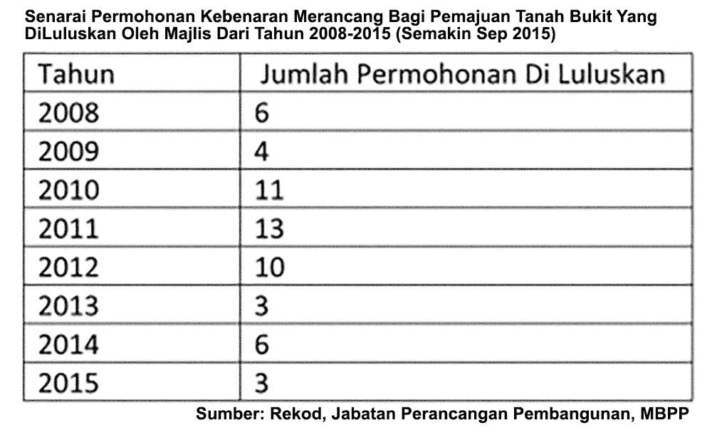
Of the 56 projects approved between 2008 till September 2015, only six were approved in 2008 and 50 were approved from 2009 onwards. It may be that some of these projects were initially approved before 2008. However, every planning permission is valid for one year and has to be renewed annually, at which time the Council has the right to impose new conditions or decline re-approval.
Singh should explain whether all of the above projects were below 76m. Even if they are, what was crucially left out was the projects could be below 76m but with hill slopes of greater than 25 degrees.
Are these not sensitive hill land or hillslopes with high risks? The officials should not play with words as lives have been lost.
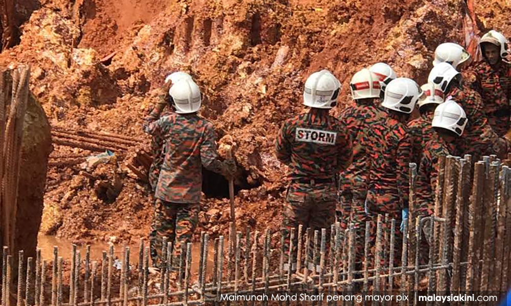
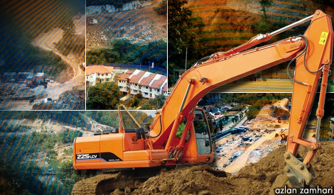
The landslide that occurred near Lembah Permai (photo) on Oct 21, 2017, was on land below 76m and ostensibly on slopes of less than 25 degrees, as it was categorized as class 2 land (with slopes of between 15 to 25 degrees). If such calamities can happen in class 2 land, what more with class 3 land?
Again, our officials like to play with words. Penang Chief Minister Lim Guan Eng, Penang Deputy Chief Minister II P Ramasamy, and Jagdeep Singh have all claimed that the project was not on hill land but on “flatland”. Even the president of the Institute of Engineers Tan Yean Chin echoed the politicians’ claim that “the Tanjung Bungah development is not on the hillslope but on the land adjacent to the hill slope.”
What is their definition of flat land? Are they confusing “low land” (land below 76 metres above sea level) with “flatland”? Is this class 2 hillslope land regarded as flat land? It may not be hill land, if “hill land” is defined as land above 76m, but it certainly is not flatland.
Politicians can play with words, but not people’s lives. Many residents from Sungai Ara to Paya Terubong, to Miami Green have vocally demonstrated their concerns and demands which I hope the government will heed.
When the politicians visited the tragedy site, they saw construction on flatland. Did they not know that the flat land they saw was created by cutting into a pre-existing natural slope so that the new “flatland” is now adjacent to a man-made slope that has been made more unstable and risky? It was precisely the newly cut slope adjacent to the building site on flatland that collapsed and buried 11 people.
If politicians continue to be defensive and insist that they did not approve any projects above 76m and that the Granito project in Tanjung Bungah was built on flatland despite facts to the contrary, does it bode well for our future?
LIM MAH HUI is the former city councilor of MBPP.
The views expressed here are those of the author/contributor and do not necessarily represent the views of Malaysiakini.