


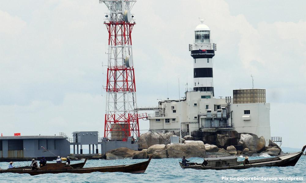

'New evidence' comprises colonial telegram, naval incident report and map
Attorney-general Mohamed Apandi Ali and his team have filed new evidence in their Feb 2 application for judicial review of the 2008 award of Pulau Batu Puteh to Singapore by the International Court of Justice (ICJ) in The Hague, Netherlands.
This was to overturn the May 23, 2008 ICJ decision that Singapore had sovereignty over Pulau Batu Puteh, while Malaysia owned Middle Rocks, and South Ledge belonged to the state in whose territorial waters it is located.
According to the South China Morning Post in an article yesterday, Malaysia’s “new evidence” comprises a letter by Singapore’s top colonial official in 1958, a naval incident report the same year, and a map of the Lion City in 1966.
Attorney-general Mohamed Apandi Ali and his team have filed new evidence in their Feb 2 application for judicial review of the 2008 award of Pulau Batu Puteh to Singapore by the International Court of Justice (ICJ) in The Hague, Netherlands.
This was to overturn the May 23, 2008 ICJ decision that Singapore had sovereignty over Pulau Batu Puteh, while Malaysia owned Middle Rocks, and South Ledge belonged to the state in whose territorial waters it is located.
According to the South China Morning Post in an article yesterday, Malaysia’s “new evidence” comprises a letter by Singapore’s top colonial official in 1958, a naval incident report the same year, and a map of the Lion City in 1966.
It quoted court documents stating that the above was unearthed during research conducted by the Malaysian legal team at the British archives between Aug 4 last year and Jan 30 this year.
The article stated that according to court filings, the first document is a confidential telegram in 1958 sent by the then Governor of Singapore to the secretary of state for the colonies in London showed he “did not consider the island of Pedra Branca/Pulau Batu Puteh to be part of Singaporean territory”.
The second document is a naval incident report, addressed to the Governor of Singapore, which said a British naval vessel could not assist a Malaysian vessel being followed by an Indonesian gunboat as it “was still inside Johor territorial waters”.
The third article is a map dated 1962 but with markings dated February 1966 that the Malaysian filing said showed Singapore’s territorial waters “do not extend to the vicinity of Pedra Branca/Pulau Batu Puteh”.
The report stated that Singaporean officials said they were reviewing Malaysia’s application and had assembled a legal team comprising the key members who led the 2008 legal battle.
Singapore attained independence from the federation of Malaysia on Aug 9, 1965. A dispute began between the two neighbours around 1979 over the island which occupies a strategic position in the waters and international sea lanes between them, when Malaysia published a map showing the isle as its territory.
Pulau Batu Puteh is roughly 40 km from Singapore and 19 km from the coast of Johor. The Horsburgh Lighthouse was built and operated by the British in 1851, and later maintained by Singaporean officials.


Are you sure you want to delete this comment?
This action cannot be undone.