


/file/publisher-c1a3f893382d2b2f8a9aa22a654d9c97/2021/01/a74d1d87d9efd26f1814e24d5c57c412.jpg)

KINIGUIDE | The bridge Penang's LRT still needs to cross
Yet amid the flurry of activity, one crucial fact may have been overlooked: its “final piece” - the cross-channel segment linking Penang Island and the mainland - has yet to receive approval.
Currently, two concurrent public processes concern this missing segment.
MRT Corp is displaying the Revised Railway Scheme for public feedback until May 24. Separately, the environmental impact assessment (EIA) report is on public display from March 9 to April 7, with feedback open until April 22.
Since the Revised Railway Scheme offers only key highlights and a handful of layout plans, this KiniGuide draws primarily from the EIA report, which is fully available online, offering readers a quick overview of its potential impacts on the environment, navigation, heritage, and land use.
What is the Penang Mutiara Line (PML)?
The PML, formerly known as the Bayan Lepas LRT (BLLRT), was initially a...
KINIGUIDE | After years of planning and debate, Penang’s first light rail transit (LRT) Mutiara line has finally entered an intensive construction phase. Road closures, tree clearing, heavy machinery, and piling works can be seen along the alignment.
Yet amid the flurry of activity, one crucial fact may have been overlooked: its “final piece” - the cross-channel segment linking Penang Island and the mainland - has yet to receive approval.
Currently, two concurrent public processes concern this missing segment.
MRT Corp is displaying the Revised Railway Scheme for public feedback until May 24. Separately, the environmental impact assessment (EIA) report is on public display from March 9 to April 7, with feedback open until April 22.
Since the Revised Railway Scheme offers only key highlights and a handful of layout plans, this KiniGuide draws primarily from the EIA report, which is fully available online, offering readers a quick overview of its potential impacts on the environment, navigation, heritage, and land use.
What is the Penang Mutiara Line (PML)?
The PML, formerly known as the Bayan Lepas LRT (BLLRT), was initially a Penang government initiative. Following the formation of the Anwar Ibrahim government, Putrajaya took over the project, appointing MRT Corp and its wholly owned subsidiary MRT Mutiara Sdn Bhd (MRTM) as developer and asset owner.
An extension across the Penang Strait was subsequently added - but on condition that the Penang South Reclamation (PSR) project, originally intended to finance the LRT, be scaled down from three islands to one: Silicon Island, planned off the south coast of Penang Island.
The PML is designed to carry up to 10,910 passengers per hour per direction, to raise public transport modal share to 40 percent. That said, projected daily ridership in its first year stands at 45,600.
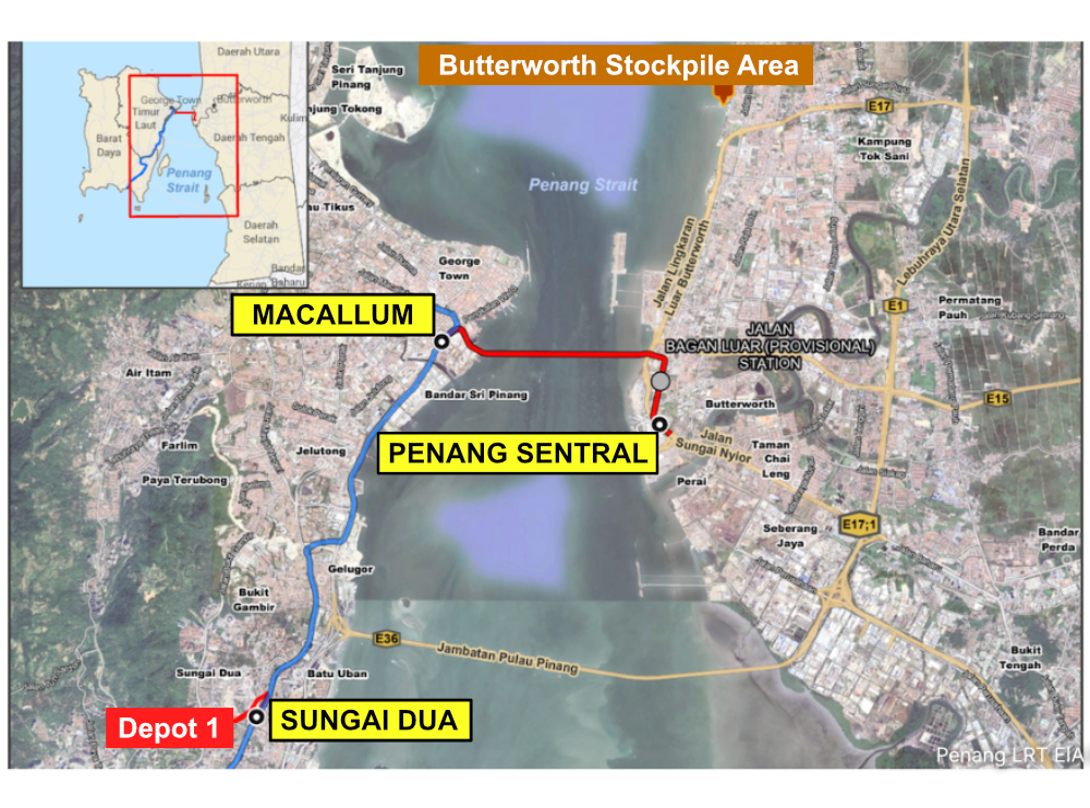
The full alignment spans 29.67km across two sections: a 23.67km first segment (Komtar to Silicon Island) and a 6km second segment (Macallum to Penang Sentral) - the latter being the unapproved “final piece” of the project.
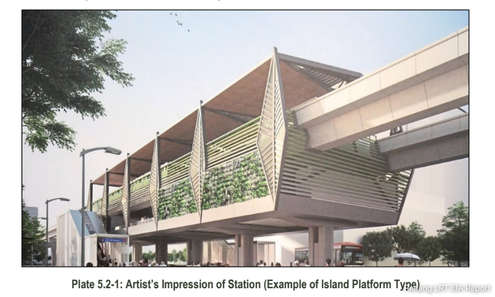
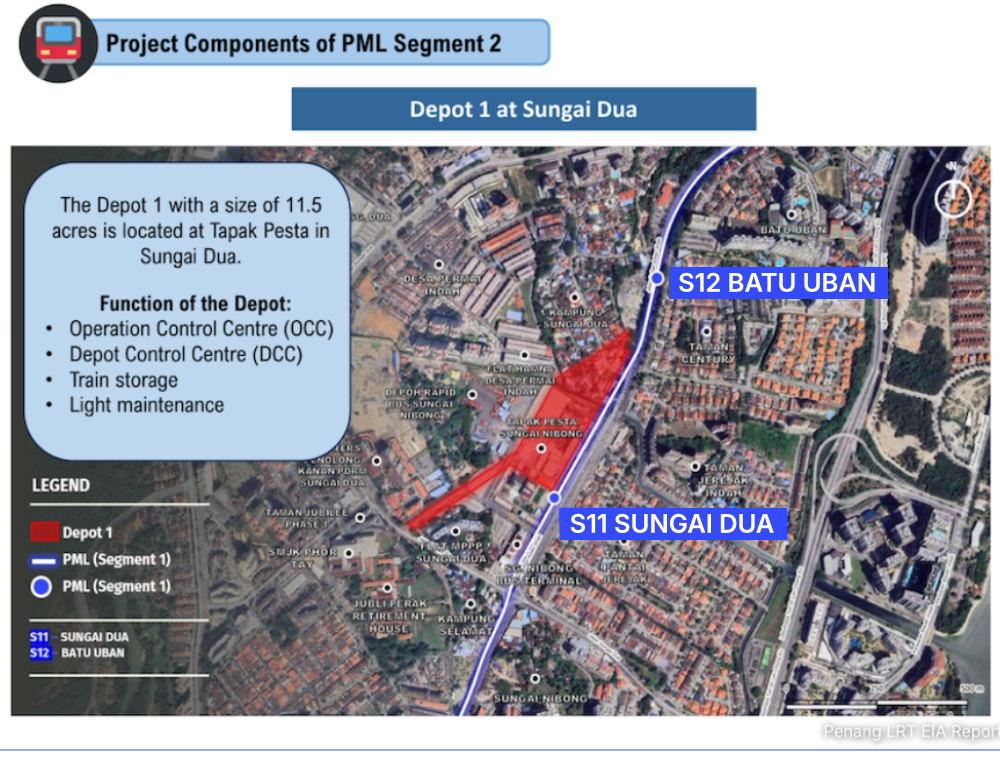
The PML will feature 22 elevated stations, including two provisional stations at Silicon Island and Bagan Luar, along with seven park-and-ride facilities and two depots. The main depot, located on Silicon Island, will handle heavy maintenance, while a secondary depot in Sungai Nibong will handle light maintenance.
The project was first estimated to cost RM10 billion. With the second segment added, that figure rose to RM16.8 billion. Transport Minister Anthony Loke has set the cost ceiling at between RM16 billion and RM17 billion.
The line is targeted for completion in 2031. Construction of the first segment began last year, with SRS Consortium appointed as the main civil works contractor. Subject to approval, work on the second segment is expected to begin in January next year.
Is the second segment a new proposal?
No. The concept was already outlined in the Penang Transport Master Plan, launched a decade ago, which envisioned a line from “The Light” station on the island to the Perai area on the mainland. MRT Corp’s current alignment shifts this to maximise coverage.
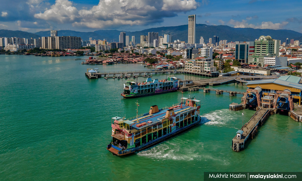
At present, travellers between the island and mainland have three options: the Penang Bridge, the Second Penang Bridge, and a speedboat service, which replaced the old ferry and carries only motorcycles, bicycles, and pedestrians.
Another long-mooted alternative is the controversial undersea tunnel project.
How many assessment reports has the PML submitted?
The project has a long paper trail. For the first segment alone, two railway scheme reports and two EIA reports were submitted.
On Feb 21, 2022, the Environment Department (DOE) approved only part of the first segment’s alignment, covering the stretch from Komtar to Permatang Damar Laut.
The section from Permatang Damar Laut to Silicon Island required a separate EIA submission based on detailed plans for the island’s topside development, which was eventually approved on July 15, 2024.
As for the railway scheme reports, the Komtar–Permatang Damar Laut section was approved on July 16, 2019, while the Permatang Damar Laut–Silicon Island section received approval on Sept 30, 2024.
Meanwhile, the social impact assessment (SIA) reports were approved on June 19, 2020, and April 10, 2025, respectively.
The reports now on public display relate to the second segment: a revised railway scheme report - conditionally approved on Feb 6 this year - and its corresponding EIA report.
Highlights of the Revised Railway Scheme
First, the 6km second segment runs from Macallum station to Penang Sentral. More than half of it – 3.05km - will be a cross-channel viaduct over the Penang Strait.
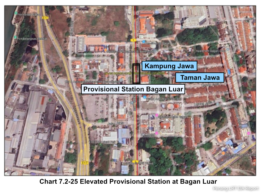
Second, a provisional station is planned between the Taman Selat and Taman Jawa commercial areas in Bagan Luar, Butterworth.
Third, a secondary depot covering 11.5 acres (4.65ha) will be added within the former Pesta Pulau Pinang site in Sungai Nibong.
Fourth, as a result of the PSR’s scaling down, a 3.15km section along with three stations (A2, A3, and A4) has been scrapped.
Fifth, a 1.5km section linking Penang Island to Silicon Island will be retained, while the A1 station on Silicon Island has been redesignated as a provisional station to accommodate future population growth.
Are there significant environmental impacts?
For much of its length, the second segment passes through built-up areas and flat terrain. The most prominent feature is the cross-channel viaduct spanning the Penang Strait.
According to the EIA report, construction disturbance - especially during piling - is assessed as minor and localised, confined largely within the project area.
Changes to water levels, currents, and wave patterns are expected to be localised and insignificant. Sediment disturbance and potential spillages were also deemed minimal, posing no substantial threat to the marine ecosystem - a conclusion that holds even when cumulative impacts from nearby developments are factored in.
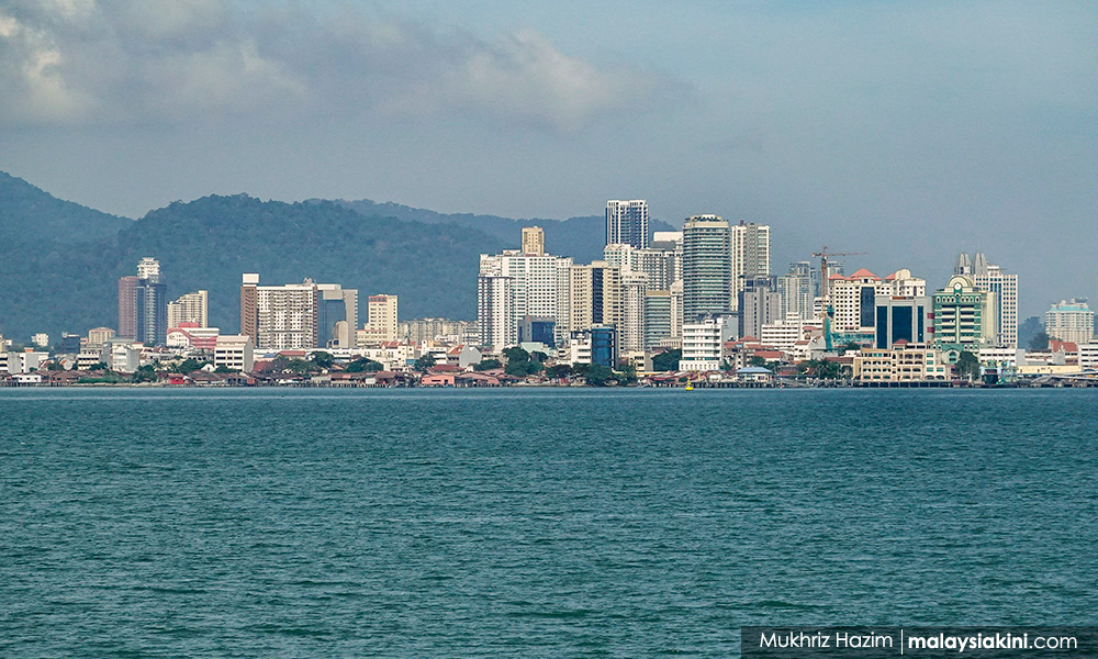
Hydraulic modelling further indicates that sediment plumes will concentrate around piling sites, with no significant effect on suspended sediment levels for fish, plankton, or macrobenthos - that is, crabs and clams.
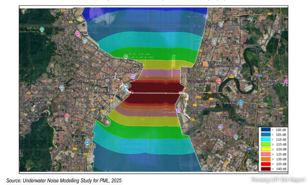
Data from eight fisheries monitoring stations show underwater noise levels ranging from 107.0 to 134.7 decibels, all within the standards set by the US National Marine Fisheries Service.
The DOE approved the Marine Hydraulic Study and the Marine Risk Assessment on Aug 28 and Oct 17, 2025, respectively.
Meanwhile, the Penang Wildlife and National Parks Department confirmed there were no complaints regarding wildlife within the project area. The depot site and its surroundings are entirely built-up, with vegetation limited to common landscape species of no conservation significance.
Will fisherfolk be affected?
Beyond general construction disruption, the EIA identifies fisherfolk operating in the Penang Strait as among those most directly affected - particularly during the building of the cross-channel viaduct.
Yet, the SIA report indicates only moderate awareness among fisherfolk. About 52.9 percent of respondents were aware of the project, while awareness of the cross-channel component was slightly lower, with 51.4 percent having little or no knowledge of it.
There are seven fish landing points within a 5km radius of the viaduct alignment: Gurney Drive, Paramount, Sungai Pinang, Jelutong, Bagan Ajam, Butterworth, and Ujung Batu.
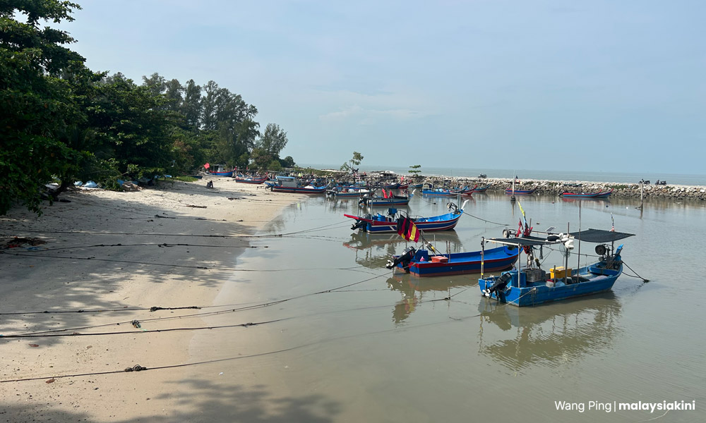
The route overlaps with fishing areas used by those employing drift nets, longlines, and small-scale gear, and parts of these waters will be temporarily closed during construction.
The movement of barges, heavy equipment, and vessels may obstruct existing routes and restrict access to traditional fishing grounds.
Fisherfolk could find themselves forced onto longer alternative routes, facing higher fuel costs and greater navigational risks - and relocating to other fishing areas risks conflict with those already working there.
Anchoring and vessel movements also raise the risk of accidents and damage to fishing gear. For small-scale fishers who depend on daily catches, any loss of equipment translates directly to lost income, making them the most vulnerable to disruption.
As for aquaculture and recreational fishing, the impact is expected to be minimal due to their distance from the construction zone.
Any reclamation? Will it affect mangroves and seagrass beds at the Middle Bank?
No land reclamation is involved, and the Middle Bank is not expected to be impacted. The construction will also not remove any mangroves.
While 49 mangrove species have been recorded within the study area, none are located within the construction footprint. Hydraulic modelling indicates that sediment plumes will not reach mangrove areas, so no significant impacts are expected during construction.
Regarding seagrass beds, studies of nearby areas recorded eight species, distributed across the Middle Bank, the uninhabited Gazumbo Island near Penang Bridge, and offshore waters near Batu Uban.
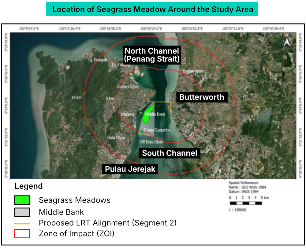
However, according to the IUCN Red List of Threatened Species, most of these seagrass species are classified under “Least Concern”, and all are considered native to Malaysian waters.
Similarly, studies showed that sediment plumes will not extend to seagrass habitats. As a result, the construction of the cross-channel viaduct is not expected to have a significant impact on seagrass beds.
Does it threaten marine mammals?
The EIA report covers three types of marine mammals: dolphins, dugongs, and sea turtles.
In Penang waters, sightings have included the Indo-Pacific finless porpoise, Indo-Pacific bottlenose dolphin, Indo-Pacific humpback dolphin, and Irrawaddy dolphin. The latter two are more common, typically found in waters 20-30m deep and near the coastline.
Leela Rajamani, a marine conservation biologist at the Centre for Marine and Coastal Studies (Cemacs), concurred that the project area hosts Indo-Pacific humpback dolphins and may occasionally be visited by Irrawaddy dolphins.
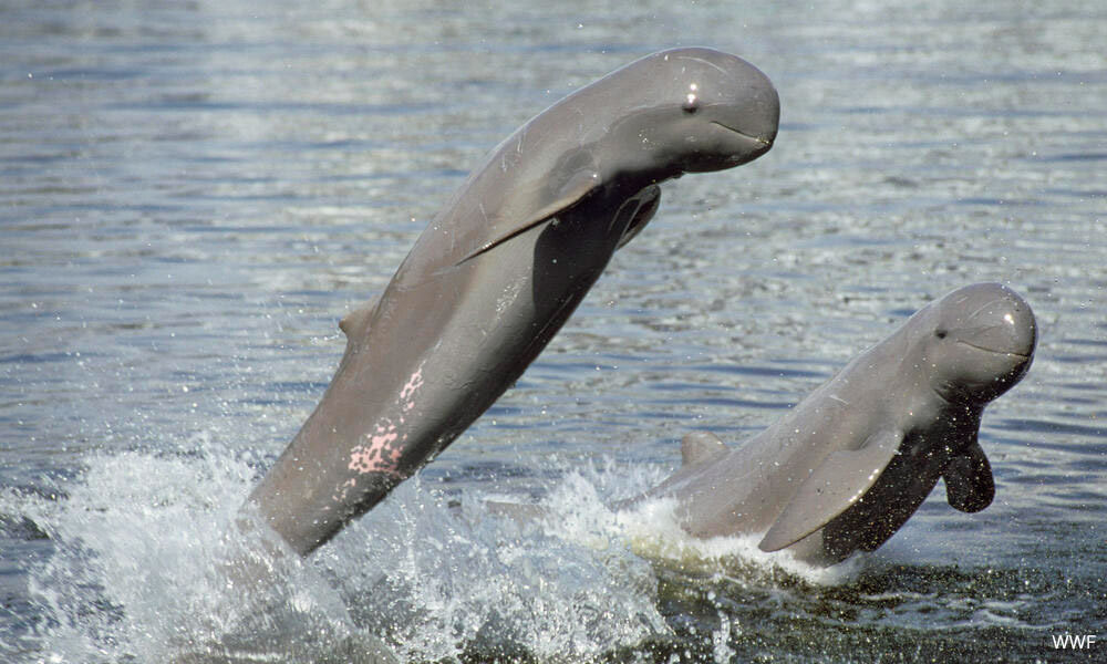
These species rely on echolocation for communication and navigation. Noise and vibrations from construction could interfere with these vital activities.
She stressed that noise assessments must account for underwater sound impacts, as these could force dolphins to abandon their natural habitats or even alter their migratory routes.
The EIA report nonetheless notes that interviews with local fishers indicate that marine mammals are more frequently seen along Penang Island’s west coast (from Teluk Bahang to Gertak Sanggul) and near Pulau Kendi, while sightings in the Penang Strait are rare - the busy shipping and boat traffic means dolphins generally avoid the strait, making their presence near the project site unlikely.
Construction - particularly piling - generates underwater noise that could disturb dolphins, affecting communication, behaviour, and stress levels, and potentially causing temporary or permanent hearing loss. The knock-on effects could extend to feeding, mating, nursing, and sheltering.
The report estimates significant effects are confined to within roughly 30m of piling locations.
Meanwhile, dugongs are generally not present in Penang waters, according to the Penang Fisheries Department.
On sea turtles: both the Fisheries Department and local fisherfolk confirm there are no nesting sites within 5km of the project.
The nearest known nesting site is approximately 10km away at Tanjung Bungah, which hydraulic modelling shows sediment plumes will not reach it. Significant impacts on sea turtles during construction are therefore not expected.
How was the marine viaduct route determined? Will it affect shipping lanes and port operations?
MRT Corp evaluated multiple route options and navigation-clearance designs, balancing engineering challenges against cost.
The design also had to account for three submarine pipelines carrying treated water from Seberang Perai to Penang Island, air clearance limits, and cargo vessel access to Penang Port.
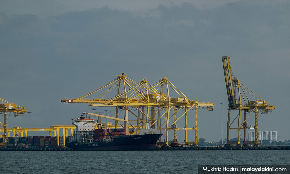
The main shipping route expected to be most affected runs from the northern channel (Tokong or Russian buoys) to Butterworth Wharves, the Vegetable Oil Tanker Pier, and the Bagan Luar Cargo Terminal. This route also serves several private terminals, including Shell Bagan Luar, Petron Bagan Luar Terminal, and Chevron Bagan Luar Terminal.
Automatic Identification System (AIS) data from 2023 recorded 826 vessels passing through the area beneath the proposed viaduct.
Two options were considered for the marine viaduct design: dual 450m span or single 600m span. Both options provide a vertical clearance of 62.31m from the Highest Astronomical Tide to the bottom of the bridge. The Transport Ministry chose the dual 450m span option.
The Marine Risk Assessment involved 26 full-mission ship simulations under various conditions.
Analysis using the International Waterways Risk Assessment Program found that, with around 1,700 vessel transits per year, the probability of a collision with the viaduct under proposed controls is extremely low and meets international safety standards.
The dual 450m span further reduces risk by giving vessels greater manoeuvring space and more efficient traffic distribution, while keeping emergency response feasible.
On balance, the dual 450m span offers greater flexibility, safer geometry, and better long-term resilience - supporting safe port operations while protecting both infrastructure and the surrounding environment.
Land acquisition
Besides government land, the project is expected to acquire 45 privately owned lots: eight on the northeast side of Penang Island and the remaining 37 in Seberang Perai, mainly around Bagan Luar in Butterworth.
Will it threaten Unesco status or heritage buildings?
The Penang Island segment runs along the buffer zone of the Unesco World Heritage Site, near the settlement at Red Lamp Corner (Ang Teng Kak), without intruding into the heritage site or demolishing any heritage buildings.
According to the heritage assessment report, 11 buildings with heritage value are located within 100m of the project boundary.
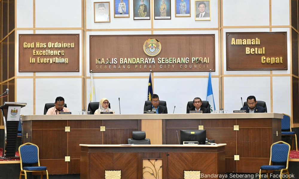
Among them, Butterworth Convent High School and Butterworth Railway Station are gazetted heritage buildings under the National Heritage Department. The former, along with St Mark’s Church in Butterworth, is also classified as a Class 2 heritage building by the Seberang Perai City Council.
The viaduct would have minor to moderate visual impacts on landmarks such as San Jiang Tai Por Kong Temple, Mazu Temple, Hean Boo Thean Temple, Butterworth Convent High School, and St Mark’s Church, with minimal effect on their cultural value.
Key sightlines within the George Town World Heritage Site buffer zone are preserved, posing no adverse impact on its Outstanding Universal Value (OUV). Some indirect visual effects on the broader buffer zone environment - such as at Red Lamp Corner - remained possible, however.
The Penang government is seeking proposals to redevelop Red Lamp Corner.
Of the heritage buildings assessed, Butterworth Railway Station faces the least visual impact – the building has been reconstructed and is assessed as lacking historical or architectural significance.
Street-level view studies found no direct or indirect obstruction to heritage streetscapes or landmark skylines, as most heritage façades face inland rather than the strait.
The proposed depot at the former site of Pesta Pulau Pinang has no heritage structures.
Intangible cultural heritage - local trades, rituals, and festivals - faces negligible impact. Traditional industries in the area will not be directly affected once the LRT is under construction or in operation.
Nevertheless, authorities are urged to maintain communication with fisherfolk and waterfront users to safeguard maritime-related cultural practices, including religious and cultural events such as the Nine Emperor Gods Festival.
Coordination with local communities is also required to manage and mitigate temporary impacts on cultural and religious processions during construction.
How has the public reacted?
A survey of 1,001 respondents - covering 651 households, 200 commuters, and 150 others - found that over 90 percent support the second segment, with 75 percent saying they are very likely to use it.
Consultations spanning six focus groups, nine case interviews, and 12 meetings involved 291 stakeholders across government agencies, public facilities, residential areas, commercial entities, religious institutions, NGOs, and educational institutions.
Not everyone is on board. Sahabat Alam Malaysia (SAM) and Jaringan Ekologi dan Iklim (Jedi) opposed the project, citing environmental concerns and questioning whether it is more necessary than restoring ferry services.
They also raised safety concerns over the viaduct’s height, noting that stronger winds under climate change could affect the bridge and train stability.
A Jedi representative suggested relocating the depot from the Pesta Pulau Pinang site to Seberang Perai, where land is plentiful and more affordable - a view echoed by the Penang Economic Planning Unit, which manages the site.
The unit noted that the RM700 million plot is not only the state government’s largest land reserve and a key future revenue source, but also a venue for major events.
SAM president Meenakshi Raman also pointed out that the group’s ongoing appeal against the Penang South Reclamation project in the Court of Appeal means the broader plan remains subject to change - even as the state government displays a draft 2050 local plan for the island.
While public consultations continue, Penang’s most ambitious infrastructure project in a generation is racing ahead on one front while its most consequential piece - the crossing that would finally tie the island to the mainland by rail - still awaits a green light.
/file/publisher-c1a3f893382d2b2f8a9aa22a654d9c97/2025/05/4395131da8b9ea0a1867a5ca5dc8d8e4.jpg)
/file/publisher-c1a3f893382d2b2f8a9aa22a654d9c97/2025/01/e6cb5cf916a9709bb893039940f0baa8.jpg)
/file/1349/c302c8cb34fb7e97931d383552cd9f2b.jpeg)
/file/publisher-c1a3f893382d2b2f8a9aa22a654d9c97/2024/12/8c2f50db4f50a918c8f0d074f136ec3d.jpg)


Are you sure you want to delete this comment?
This action cannot be undone.