


/file/publisher-c1a3f893382d2b2f8a9aa22a654d9c97/2022/12/5d9785e8a46bd3647e68a600a8342a17.jpg)

KINIGUIDE | Batang Kali landslide tragedy and the forensic report
This Kiniguide takes you through the key details of the tragedy, and findings from the report...
KINIGUIDE | Yesterday, the government released the forensic report on the landslide in Batang Kali, Hulu Selangor, which occurred on Dec 16 last year.
This Kiniguide takes you through the key details of the tragedy, and findings from the report.
What is the Batang Kali landslide tragedy?
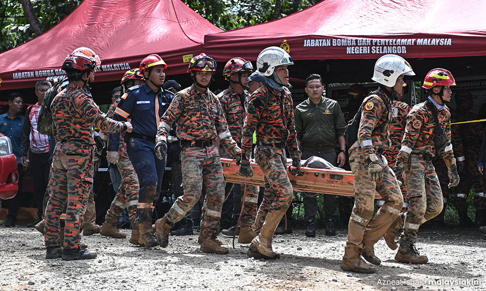
The tragedy was a landslide at Jalan B66, Batang Kali-Genting Highlands, Selangor, which killed 31 people on Dec 18, 2022. It was the deadliest landslide in Malaysian history.
Casualties include 13 children from SJK(C) Moon Choong in Kuala Lumpur, who were camping at Father's Organic Farm, on a school trip. The youngest victim was six years old.
Sixty-one others survived, seven of whom sustained injuries.
What happened that day?
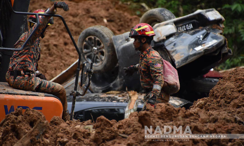
At 2am, on Dec 18, two slope failures happened 20 minutes apart.
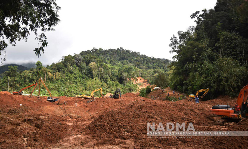
The debris flowed some 550m to reach the organic farm-cum-campsite.
The first slide was smaller and the debris nearly hit the restroom.
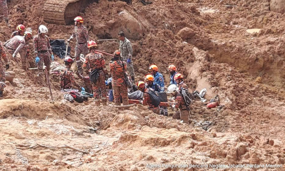
After the incident, the farmer's operator, Frankie Tan, said he went to the nearby tents and urged them to evacuate to higher ground.
Soil, rocks and trees accumulated from the first landslide formed an “artificial temporary dam” but the water flow from the collapsed scarp and existing river water broke this dam.
“After 20 minutes, the temporary dam broke, resulting in the second landslide mass in the form of debris flow, covering the entire campsite.”
Some 283,000 cubic metres of soil and debris were carried in this debris flow. This would have filled more than 113 Olympic-sized swimming pools.
Who owns the land?
The incident happened on agricultural land held on a 99-year lease by Malaysia Botanical Gardens Resort (MBGR) Sdn Bhd.
The land, leased from the state agency Selangor Agricultural Development Corporation (PKPS), borders a forest reserve.
Although the plan was to build a resort and botanical gardens, the land was instead used as an organic farm and a campsite, without the necessary approvals.
Father's Organic Farm (formerly known as Tanah Gaia Sdn Bhd) leased the land from Malaysia Botanical Garden Resort from 2016 to 2017 and took over management of the area after the contract expired.
The board members of Malaysia Botanical Garden Resort are Kong Hong Kong, Tiiong Tjuan, and Ong Yeh Kim.
Kong is a well-known philanthropist, who also founded Nirvana Asia Group, the largest "integrated funeral services" provider in Malaysia.
Nirvana provided funeral services to the landslide victims, but at the time Father's Organic Farm denied it was linked to Nirvana.
Malaysiakini's checks found Kong owns the majority of Malaysia Botanical Gardens Resort, the firm which allowed the farm and campsite to operate there.
If a campsite and farm wasn't supposed to be there, what was?
On Nov 4, 2019, Malaysia Botanical Gardens Resorts submitted an application for Planning Permission to develop a “resort peranginan” (tourism resort) for 201.91 acres of land. The plan contained three components:
Chalets and resort facilities (9.66 acres)
Botanical gardens (186.74 acres)
Road (5.51 acres)
In fact, the plan to develop this resort started in February 2006.
At the time, state agency PKPS had applied with the Hulu Selangor district council for permission to develop the Malaysia Botanical Gardens Resort there.
This application didn't pass because it needed extra approval from the local planning authority.
Six years later, in September 2012, the council through its planning department made a preliminary comment on the proposal, referring it to a state technical committee for development in environmentally sensitive areas.
Four years later, in February 2016, the committee suspended the application because the National Physical Plan Report 2 prohibits such developments on high ground exceeding 1,000m from sea level.
The decision was upheld even after it was reviewed in October 2016 and it was again stressed that only agricultural activities are allowed.
The interested parties again tried to seek permission to develop the resort in 2017, through the state's One Stop Centre Committee.
The application didn't go through again due to several reasons, including the fact that the lease between PKPS and Malaysia Botanical Gardens Resort stated that the land should only be used for agriculture and animal husbandry and that various impact assessments and technical approvals were not secured.
These hurdles were apparently finally surpassed in July 2019, the development was approved and Malaysian Botanical Gardens Resort submitted its planning permission to the local council in November of that year.
The outcome of that application, however, was not disclosed in the report.
When contacted, Kong said the plan to build the resort is shelved.
Was the landslide an isolated case in the area?
The scale of the 2022 landslide was severe but the report found many traces of smaller landslides scattered in the area.
This, it said, demonstrated the effects of land movement which had happened since 1991.
What was the weather like prior to the landslide?
The landslide did not happen on the day with the most rainfall for that month.
However, the report noted that heavy rainfall days before could also trigger landslides.
Investigators found the slope structure “experienced high-water saturation and the soil consistency exceeded the liquid limit” during the landslide.
So what were the reasons for the landslide?
Investigators blame two triggers unrelated to human activity.
The first is the presence of a “fault zone”, where natural boreholes in the granite pointed to weakness in the subsurface. This, they said, was exacerbated by the presence of groundwater flow.
The second is the natural configuration of the land, whereby the valley was naturally at risk, being in the middle of two hilly areas of steep slopes.
“While satellite images from March 2018 indicate some human activities in the area, it is challenging to establish a significant causal relationship between these activities and the occurrence of the observed landslide,” the report read.
What do investigators propose?
Investigators proposed mitigation and prevention measures and a slope hazard risk map.
This includes extending the implementation of the National Slope Master Plan (2009-2023) for the next 15 years to enhance slope management, especially in the face of climate change.
They also proposed the use of advanced technology to detect risks of slope failure, and the enforcement of laws and guidelines for camping and recreational sites.
/file/publisher-c1a3f893382d2b2f8a9aa22a654d9c97/2023/10/0c59064edc2b88b33b12f4bfeaaa50d5.jpg)
/file/publisher-c1a3f893382d2b2f8a9aa22a654d9c97/2023/10/764cdca43da3828db2f10199ca88bb8a.jpg)
/file/publisher-c1a3f893382d2b2f8a9aa22a654d9c97/2023/09/7cd18abddcbf0c8a6cad814e93d56c8d.jpg)
/file/publisher-c1a3f893382d2b2f8a9aa22a654d9c97/2023/02/f2efa664b45c434941e466aa73933fc0.jpg)
/file/publisher-c1a3f893382d2b2f8a9aa22a654d9c97/2023/02/18655240bd7ac4c59a9f0d9fb1d44bb9.jpg)
/file/publisher-c1a3f893382d2b2f8a9aa22a654d9c97/2022/12/440154625a6afb8a1a5735adfc3afa16.jpg)
/file/publisher-c1a3f893382d2b2f8a9aa22a654d9c97/2022/12/b6ef22e9f6f880cb6d608e32682969ea.png)


Report this comment
Are you sure you want to delete this comment?
This action cannot be undone.